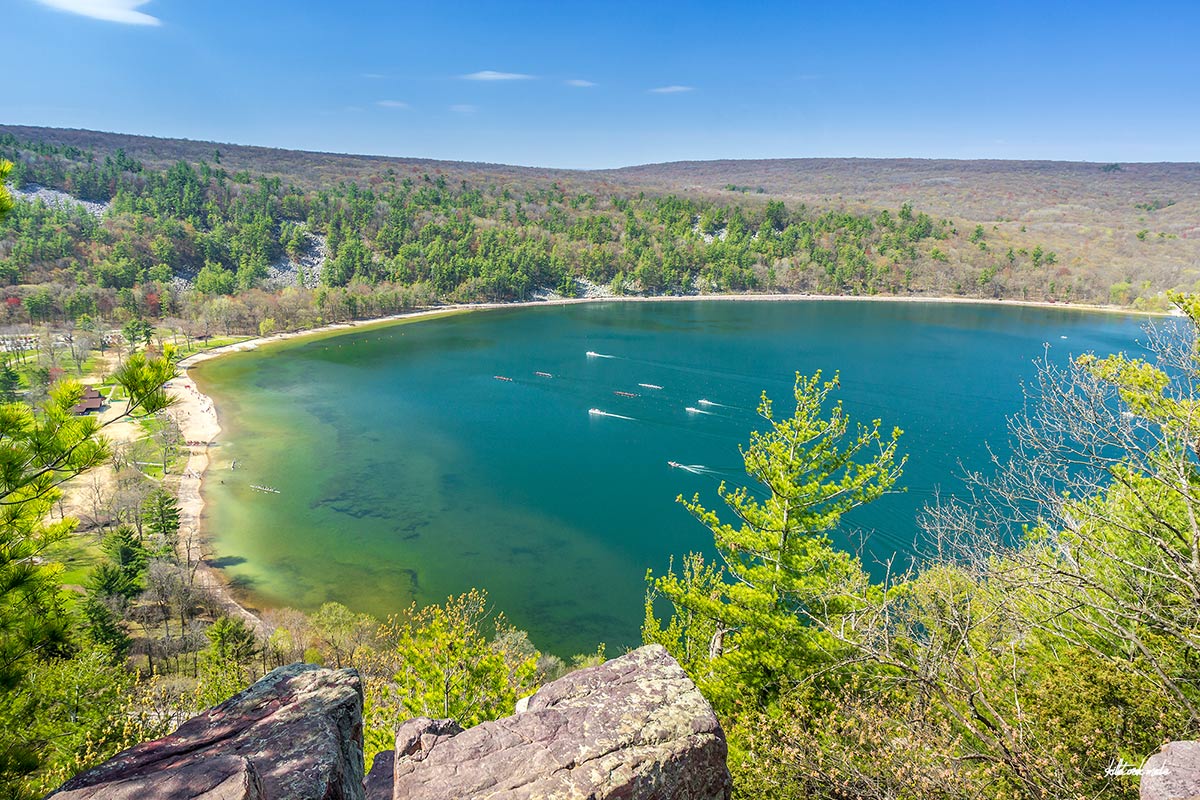
Devil's Lake State Park is excited to host the 2024 Big Ten Women's Rowing Championships…
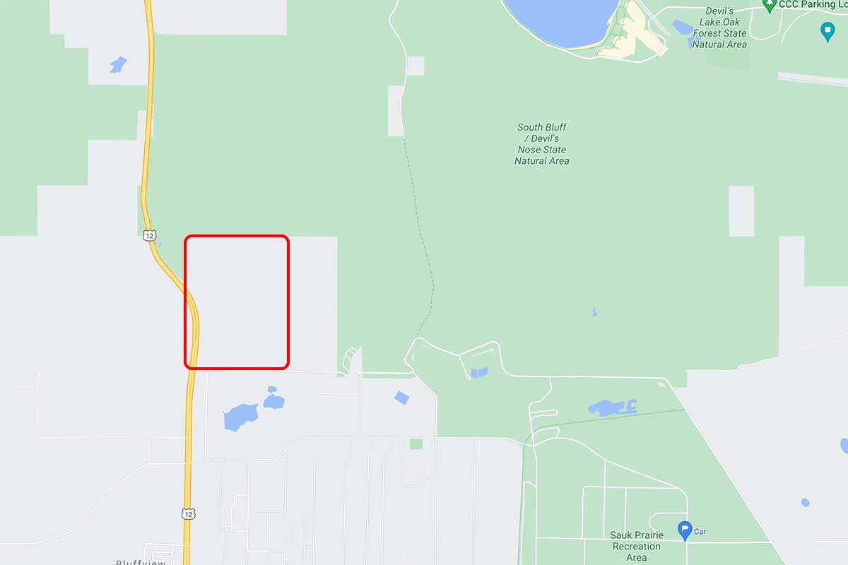
Yesterday area news outlets began to report that the Wisconsin Natural Resources Board approved the purchase of 220 acres within the park’s project boundary for $1.64 million. This is great news!
However, it’s worth noting that this property is not “additional recreational land” in the sense that many folks are understanding it. The property is located on the southwest corner of the park with Highway 12 as a border on the west, Ho-Chunk Nation property on the south, and a small island of Nature Conservancy land on the eastern side. (See the Google map above or check out this detailed PDF.) This is a forested slope on the south bluff that is really only accessible by hiking in. This land will mostly be opened up to hunting and the occasional off-trail hiker. It will NOT suddenly be a new mountain biking, hiking trail, or similar area. Not anytime in the near future anyway. So, GREAT NEWS! But not quite what some are suggesting out in social media land.

For nearly 2 decades the Skillet Creek blog has focused on 3 main goals; To inspire you to visit and explore the Devil’s Lake region, to help you get the most your visit by sharing tips, events, and other helpful information. Lastly to advocate for our environment & wildlife and talk about how we can keep our natural areas amazing now and into the future! That last goal can sometimes cause controversy, but it’s the only way we can accomplish the first two. – Derrick Mayoleth, Owner.
Related Posts
This Post Has 2 Comments
Comments are closed.
Derrick: As usual, Thank You for clarifying muttled facts. It is one thing to be excited over additional land being added to the Park but, it is not right to knowingly OVERSTATE the facts or to UNDERSTATE either. Such a common practice now a days. Thanks for being the true / reliable source for Devil’s Lake !
I would love to see the author of that article try riding his mountain bike up or down that slope–it would take $10.64 million to make a bike trail for that !
Thank you. Yep. I read one article where the spokesperson suggested fishing and skiing too.. I have to believe that he simply had no clue what he was talking about. 🙂