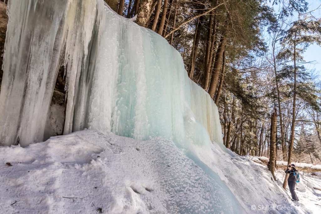
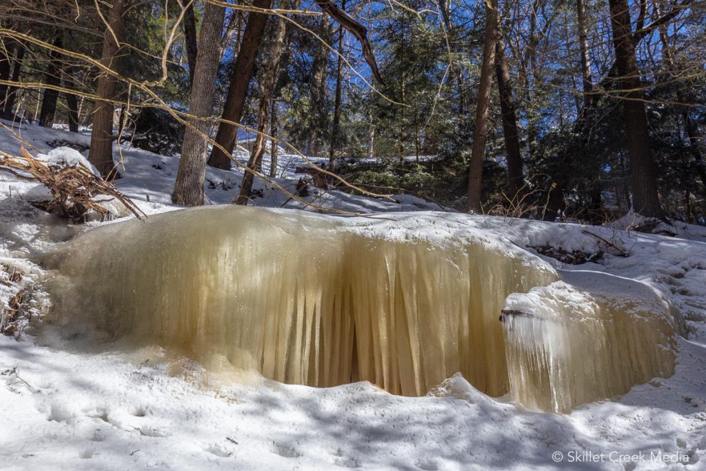
Beautiful ice formations have returned to Mirror Lake State Park! We expect the ice to…
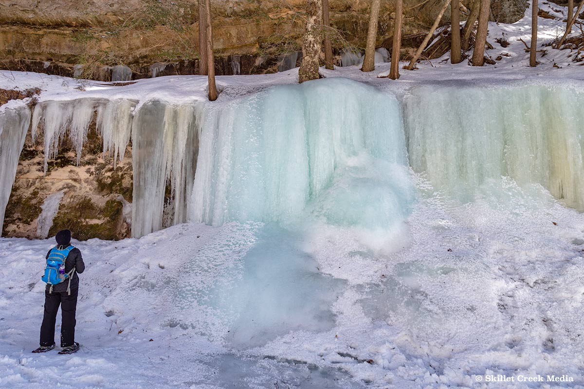
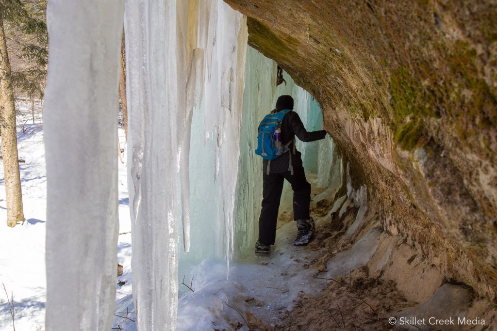
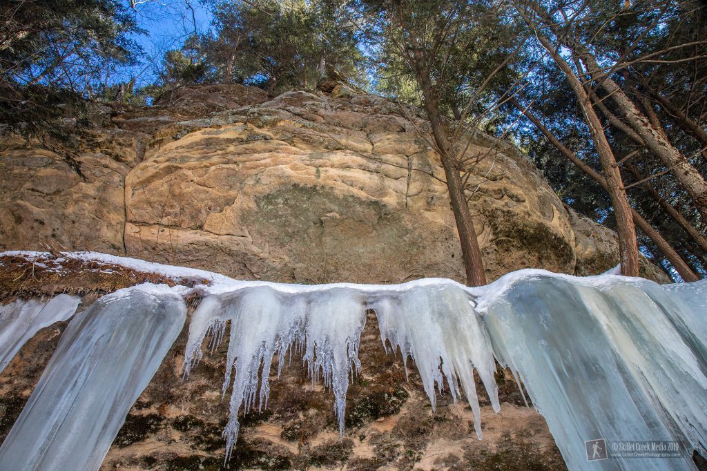
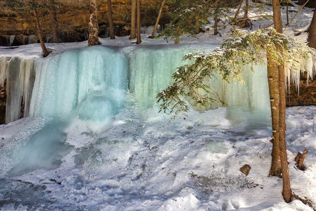
In March of 2019, the ice wall at Pine Hollow State Natural Area near Leland, Wisconsin was something to behold. Certainly worth the extra effort you have to put in to get to it. Grab your snowshoes and we’ll tell you how it’s done.
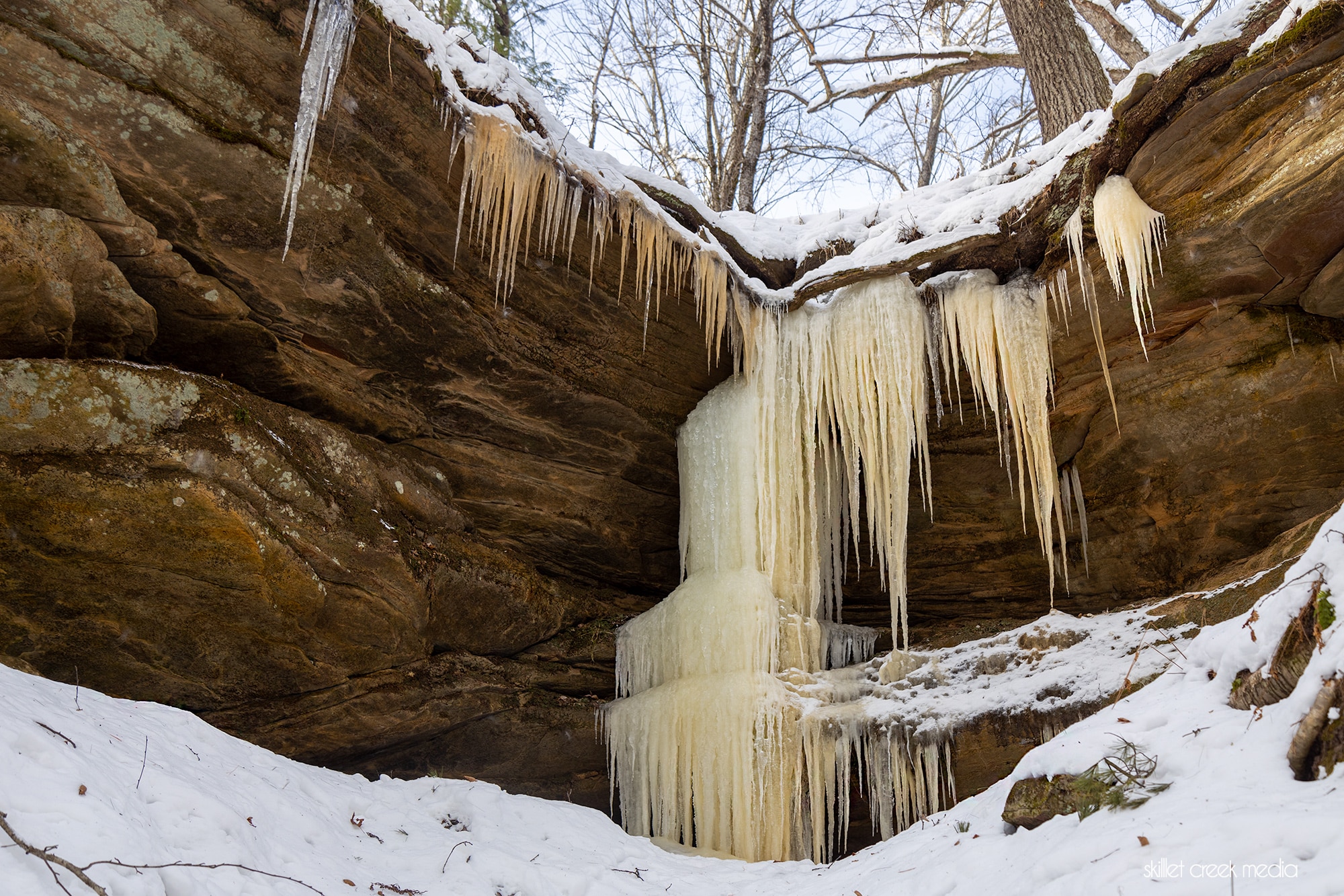
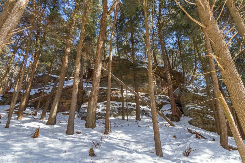
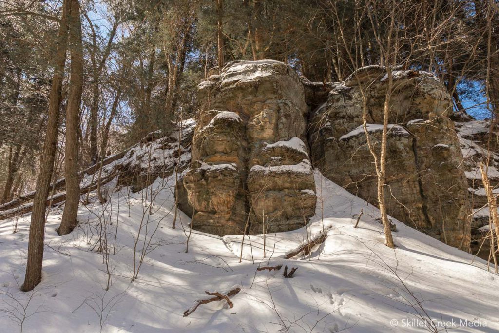
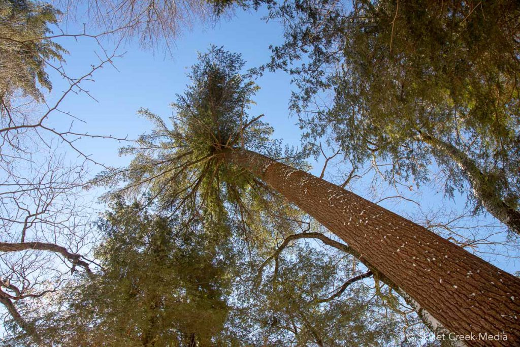
Pine Hollow State Natural area received its SNA designation in 1966 for its amazing deep and ravine that drops some 300′ with cliff walls rising up to 80 feet over the floor. The ravine provides an amazing mix of micro-climates supporting about 500 different species of plant-life, the most prominent being the thick and towering hemlock trees.
The ice wall itself is located at the very bottom of the ravine and at the border of the SNA. The neighboring property owner is accepting of the fact that no one knows where Pine Hollow begins and ends, but we do want to do our best to stay off their land and inform others where the borders are. That said, access to the ice and the hollow itself is not well mapped or described. Let me try to fix that for you.
Pine Hollow Access
The easy part is that to get over to Pine Hollow from the Devil’s Lake region you head west from Highway 12 on County Road C toward Natural Bridge State Park. You don’t quite get to the park before you have to turn right. You have two choices; Pine Hollow Road or a little further down, Orchard Road. – You can zoom out on the map below to get your bearing. :)
From Pine Hollow Road
In the summer Pine Hollow road is a good option. In the winter, it’s not. The little road will climb north of the hollow. It turns into a gravel road and there are a couple small turn arounds. There are no signs and trail heads to tell you if you’ve gone too far. You are advised by the DNR to park on the shoulder and “hike in”. In the winter when the snow is deep, there is no shoulder, no good place to park and no place to turn around. It’s not ideal. That said, if you park in the right spot, you can hike down to the ice fairly quickly. (See our map above.) Which is very tempting.
From Orchard Road
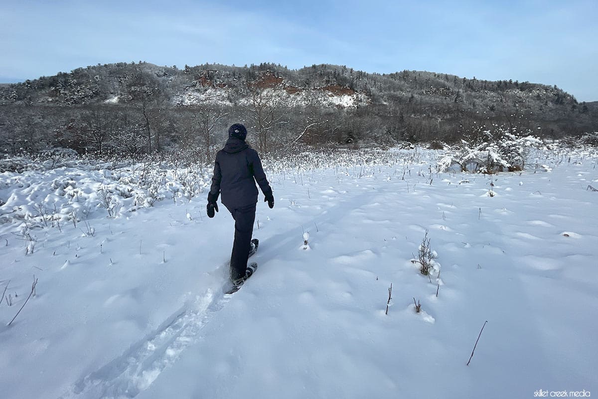
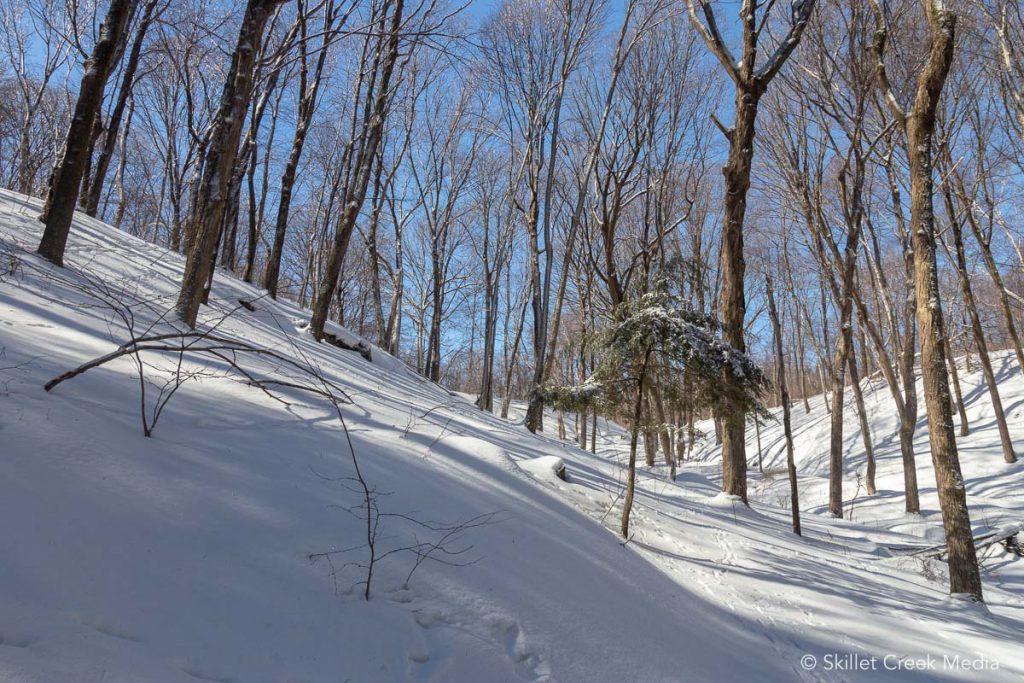
You’re second option, or your best option in the Winter is on Orchard Road. The downside of this option is that where you would normally park in summer, is not plowed in the winter. You still have to park on the road. There is also a bit of ridge and blind corner right there as well. Pull over as far as you can. The second issue with the Orchard Road option is that it’s a much longer hike. Again there are no trails. This is a hike for people comfortable in snowshoes, water crossings (if not frozen) and steep snow-covered slopes. The payoff here is that you get the full “Pine Hollow” experience traveling from the top to the bottom of the hollow and following the stream along the way.
More About The Orchard Road Snowshoe Route
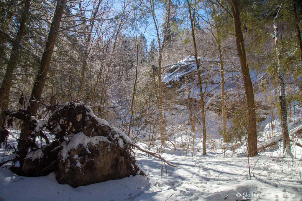
Let’s look at this Orchard Road snowshoe option a bit more. Once you’ve accepted that your car is a bit too far in the road and can focus on the hike, just head east on the trail for a while. You’ll pass a lone silo on your left and enter an obvious oak tree planting where the trees are all in a line. You’ll be tempted to cut an angle north-east to the valley, but the seemingly open area is full of thick bramble, thorny raspberry whips and prickly ash trees. Unless you’re a total masochist this option sucks. Your goal is to get into the forest before heading north. In the woods, you’ll have a pretty clear path north to the hollow. Go north, not north-east. You can’t cut corners here either because there are high cliffs. You want to get into the valley on the west or upper section, then walk down along the stream. (Review the map.) You may have to cross the stream at various locations to proceed.
Lastly, keep in mind that you’ll have to hike back up. getting back up out of the hollow is challenging physically and slippery in deep snow.
Bottom Line
Pine Hollow State Natural Area is a beautiful location with not-so-great parking or access. That said, if you’re in shape and willing to go off trail, you should check it out.
More Photos

For nearly 2 decades the Skillet Creek blog has focused on 3 main goals; To inspire you to visit and explore the Devil’s Lake region, to help you get the most your visit by sharing tips, events, and other helpful information. Lastly to advocate for our environment & wildlife and talk about how we can keep our natural areas amazing now and into the future! That last goal can sometimes cause controversy, but it’s the only way we can accomplish the first two. – Derrick Mayoleth, Owner.
Related Posts