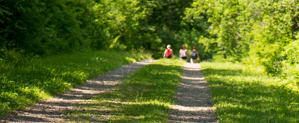
Hiking

Prairie Hill Farm
Sponsor - Luxury Home. Hiking & Biking Trails and more!

Devil’s Lake has over 29 miles of trails for any skill level. Remember to Check out our Photo Section for Pictures from the trails and many other areas of the park.

Trails may vary in difficulty. Not all trails are surfaced. Steep climbs or descents and stairways may be encountered. Use caution when on the steep bluffs or near cliffs. Stay well away from cliffs and watch small children closely. There is a 1-mile interpretive nature trail and 1.5 miles of trail that are accessible for people with disabilities.

Park Trails are not maintained for winter hiking. Winter Use Areas maps are available at the park office.

If Hiking during hunting season and you want to know where the hunters may be click here for an open hunting map.

Bicycles are allowed only on the Uplands Loop and the connector trail between the Steinke Basin Loop and the North Shore Picnic Area.


hiking in Stienke Basin

Trails & Descriptions

- The estimated hiking time is based on hiking the entire trail one way.
- Color Statements disclose the color of the markers along that trail.
- Help us control the spread of Garlic Mustard! Brush off your shoes when entering or leaving marked trails!

Balanced Rock — A difficult, steep, climbing trail with stone steps on the south face of the East Bluff. Spectacular views of Devil’s Lake with the Balanced Rock formation off to the south of the trail. (.3 mile, approximate hiking time 1 hour)

CCC – A difficult, steep, climbing trail with stone steps on the south face of the East Bluff with many scenic views. (.6 mile, approximate hiking time 1 hour)

Devil’s Doorway — This is an Easy, level asphalt trail along the edge of the top of the East Bluff to views of Devil’s Lake with drop-offs along the way. There is a notable side trail with stone steps to the Devil’s Doorway rock formation. (.5 mile, approximate hiking time .25 hour) Access to this trail is from East Bluff, East Bluff Woods, CCC, Potholes and/or Balanced Rock trails.

East Bluff – A Medium effort trail that is asphalt with stone steps as it winds back and forth between the edge of the bluff and the adjacent woods. Goes to the top of the East Bluff for many scenic views and drop-offs. Elephant Cave and Elephant Rock are at the north end. (1.3 miles, approximate hiking time 1.25 hours)

East Bluff Woods — An Easy-Medium, travel and grassy trail with one steep grade on the East Bluff between the North Shore and the Balanced Rock. Entirely in the woods. (1.3 miles, approximate hiking time 1.25 hours)

Grottos — A wide, Easy going, compacted travel path along the base of the south end of the East Bluff connecting Balanced Rock Trail, Potholes Trail, and the CCC Trails. (.7 mile, approximate hiking time 1.25 hours) Accessible
from Group Camp parking lot.

Uplands Trail Loop — A Medium effort trail that is long, winding, and grassy with variable grades through fields, brushy areas, and woods. Reaching the top of the East Bluff for some scenic views at the south end. (4 miles, approximate hiking time 2.5 hours) Bikes allowed.

Sauk Point Trail – Part of the 1,000 mile Wisconsin Ice Age Trail, this Medium-Difficult wooded, grassy trail runs between Parfrey’s Glen and the Ice Age Loop. Highlights include spectacular views to the south and the Wisconsin River. (3.97 miles, approximate hiking time 3 hours) Trail Profile & 3D Topographical Map

Johnson Moraine Loop
— An Easy, grassy trail with variable grades crossing County Hwy. DL twice. Named for the terminal moraine of the Wisconsin Glacier which it follows on the north side of County Hwy. DL.
There are a number of kettle ponds and marshes in this area. (2.5 miles, approximate hiking time 2 hours)

Parfrey’s Glen Trail
— An Easy-Medium trail with difficult creek crossings. It follows through a deep gorge left by glacial action and ending at a small waterfall. (.8 miles, approximate hiking time 1 hour) Leaving this trail is
Prohibited and subject to a fine. No food, beverages or pets are allowed.

Potholes — A very Difficult, steep climbing trail with stone steps. Good views of the south areas of the park can be seen. A series of rounded, eroded, depressions - or potholes - are located near the top. It is wooded near the bottom. (.3 mile, approximate hiking time 2 hours)

Steinke Basin Loop — An Easy, level, grassy, wooded trail through an extinct glacial lake bed. Includes bridges and a variety of land covers. (2.5 miles, approximate hiking time 2 hours)

Tumbled Rocks
— An Easy, level, asphalt walkway winding through quartzite boulders at the base of the West Bluff at lake level. (.8 mile, approximate hiking time .5 hour) 1000 feet of this trail is accessible to wheelchairs from the North Shore picnic area.

West Bluff 
— A Medium effort trail that is asphalt with stone steps and a steep climb on the south end and an easier climb up the north end. Goes across the bluff top past drop-offs with many scenic views of the lake and park. (1.5 miles, approximate hiking time 1.5 hours)

Additional information concerning accessibility of trails can be obtained from the park staff.